
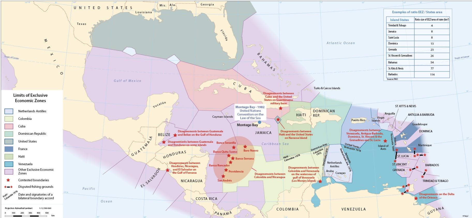
Dividing up the sea
Covering some 4 300 000 km², the Caribbean Sea and the Gulf of Mexico dominate their surrounding but frail continental or island perimeter arc. From the pre-Columbian era to modern times and through to the present, it is the multiplication and juxtaposition of zonal entities that have prevailed. Notwithstanding their vast surface dimensions, this maritime space is today entirely divided between bordering states. These invisible yet real boundaries which cut up this liquid expanse afford the region an image as complex as, but very different from, the classic political map. The smallest island can suddenly take on an unsuspected dimension, the ambitions of certain regional powers reveal themselves, and the stakes in play change in both nature and scale.
 7
7


 Report issue