Status of Marine Spatial Planning (MSP) in the Wider Caribbean Map - CLME+ HUB

Status of Marine Spatial Planning (MSP) in the Wider Caribbean Map

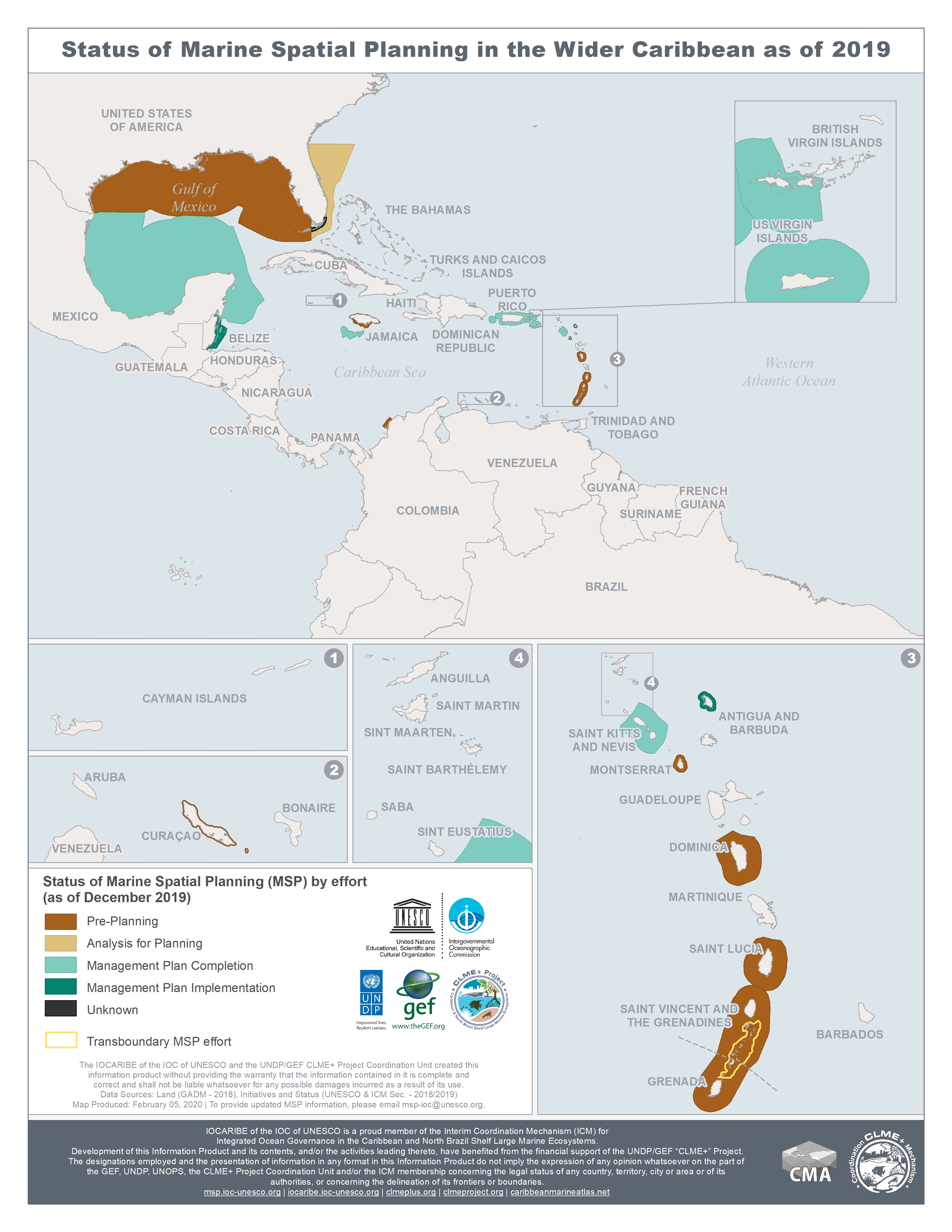
This map illustrates the status of Marine Spatial Planning (MSP) in the Wider Caribbean as of December 2019. The map shows the areas where MSP is in the pre-planning phase; in the analysis phase for planning; with the management plan completed; with the management plan implemented or where status is unknown.

Year: 2019
Author: IOCARIBE
Keywords: 
Share:
       11                          Report issue

Cookies policy

We use cookies to enhance your site experience, to provide you with extra functionalities and for analytical purposes. You can consent to the use of such technology by accepting and closing this notice. If you want to find out more, please read our cookies policy here.

Welcome to SOMEE

SOMEE content is still under development and is therefore not yet available online. However, you can already check for sample text and materials under the sections in blue text